Day 2: The peak
The next day, Wednesday, we had a full schedule involving the hike from base camp up and back from the peak, the descent back to San Gerardo de Rivas, and the long drive back to San Jose that evening. It was a total of 25 km (15mi) of hiking.
We woke up at 2am, ate a quick breakfast, and started the hike up to the peak. The climate and landscape were very different than the day before. We hiked through smaller shrubs, rocky trails, and the final part was nearly a straight vertical ascent up to the peak. This hike was in the dark under the stars, which made it easier to loose our way. The path was pretty easy to follow, except at one point when we came upon a huge rock. It was unclear where the path continued, so we followed one that we found, but it didn’t look very promising. Sure enough, we eventually turned back and wandered around the rock some more until we spotted some piles of rocks that marked the trail. In the dark we hadn’t seen the markers at first. And we weren’t the only ones that got lost at that point. We almost followed the flashlights of some fellow hikers bobbing in the distance, but they were lost too. We found the right path using the markers and continued up toward the peak.
This portion of the hike took us through the páramo ecosystem, an ecosystem particular to high tropical mountain regions of Central and South America (such as the Sierra Nevada in South America). It was chilly, rocky, and the vegetation was shorter and more spiny than the lush, green, leafy rainforests that we’d hiked up through the day before. It actually reminded me a lot of the terrain in southern Idaho, down at Jump Creek Falls or Leslie Gulch, which was surprising.
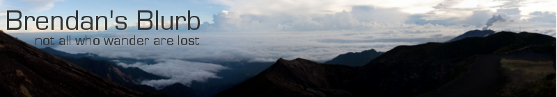
Alex and I arrived before any other hikers at 4:30am, which allowed me to take some long-exposure photographs of the starry night sky before the first rays of dawn appeared. At 5am the sun began to clear the horizon and slowly cast the mountains in a golden light. We could see the Irazú volcano, the Turrialba volcano, and the peak of Cerro de la Muerte. The peak was clear, but the coasts were cloudy so we couldn’t actually see the oceans.
The peak was marked by a sign, two Costa Rican flags, and a logbook. Gradually other hikers arrived and everyone marveled at the view while taking photos. It got cold, and windy, pretty quick. We were on our way down by 5:40am.
At this point we had hiked upward 20km (12.5 mi), ascending about 7,500 feet (2000m) in elevation. The rest of the day would be a descent back down the way we came.
We arrived back at the shelter at 7:15am, ate a second breakfast/meal, and packed up for the descent. The descent was more painful on the knees and feet than the ascent, and more difficult because the trail was muddied from rains the previous day. We hobbled into the hostel where my car was parked 5 hours after we left the base. We celebrated with a hearty meal from the restaurant at the hotel because I needed a boost of energy and a rest before taking off to drive all the way back to San Jose that evening. I needed to be back that evening because the next day at 6am I needed to head to La Carpio for computer classes. Otherwise, it would have been nice to rest in San Gerardo for another evening. The return trip through Cerro de la Muerte was rainy, cloudy, and slow going because of the huge semi’s en route between Pérez Zeledón and the Central Valley.